




01Research activity
Remote Sensing research by ScholarsColab researchers
What researchers combine with Remote Sensing
Words that appear most often in these paper titles. Tap one to see those papers.
Recent focus (2024 onwards): deep, classification, learning, data, change, monitoring.
02Researchers
PhD researchers working on Remote Sensing
Every researcher below is registered on ScholarsColab and can be hired as a mentor or for a project. Publication counts are their papers on this topic.
 Moses EMETEREBowen University6 papers on this topic · 37 citationsNNarayan VyasAssistant Professor, Department of Computer Science and Application, Vivekananda Global University, Jaipur5 papers on this topic · 2 citations
 Dr Prof Rajkumar RajamanickamMeenakshi Medical College Hospital & Research Institute, Kanchipuram, Tamil Nadu, affiliated to…2 papers on this topic · 64 citations
 SURYA PARKASH GUPTACommunity Based Disaster Risk Management Society2 papers on this topic · 2 citations
 Anju AsokanAssociate professor1 paper on this topic · 561 citationsMMasood Ur RehmanUniversity of Glasgow1 paper on this topic · 67 citations
 Farhan AadilSivas University of Science and Technology, Sivas, Turkey1 paper on this topic · 58 citations
 Dr Ramakrishna KolikipoguChaitanya Bharathi Institute of Technology Hyderabad1 paper on this topic · 44 citations
 Jacopo IannacciFondazione Bruno Kessler1 paper on this topic · 22 citations
 Dr. Yusuf PerwejPh.D1 paper on this topic · 13 citations
 Sukamal SarkarAssistant Professor Division of Agronomy, School of Agriculture and Rural Development Ramakrishna…1 paper on this topic · 13 citations
 Ankit KumarAssistant Professor1 paper on this topic · 12 citations
 Dr R A ThakurSymbiosis skills and Professional University Pune1 paper on this topic · 8 citations
 Dr. SATHISH KUMAR SELVAPERUMALAsia Pacific Univeristy1 paper on this topic · 7 citations
 Nalini Kanta SahooDirector and Principal, MIT College of Pharmacy, MIT Campus, Ram Ganga vihar,…1 paper on this topic · 6 citations
 Dr Senbagavalli MAssociate Professor, Alliance University, Bangalore, Karnataka1 paper on this topic · 6 citationsSSarwaMMU1 paper on this topic · 5 citations
 KATTUPALLI SUDHAKARDEPARTMENT OF AI&DS, LAKIREDDY BALI REDDY COLLEGE OF ENGINEERING1 paper on this topic · 5 citations
 Malak ZIRARIOrganic chemistry catalysis and environment Laboratory, Department of chemistry, Faculty of Sciences,…1 paper on this topic · 5 citations
 TSHIBANGUA WA ILUNGA JohnCarTeS Laboratory, Department of Geography and environmental sciences, University of Lubumbashi1 paper on this topic · 4 citations
 Neeraj SinghSenior Technical Lead1 paper on this topic · 4 citations
 Dr. Ajay SinghDoctorate in Food Science1 paper on this topic · 2 citations
 Dr. Sachin KumarSRM Institute of Science and Technology, Chennai1 paper on this topic · 2 citationsWWulfran FENDZI MBASSOUniversity of Douala1 paper on this topic · 1 citations
 MANIMARAN VKONGU ENGINEERING COLLEGE1 paper on this topic · 1 citations
 Sanjay AgrawalVeer Surendra Sai University of Technology Burla India1 paper on this topic · 1 citations
 Dr. Malik Muhammad AkhtarBalochistan University of Information Technology, Engineering and Management Sciences, Pakistan1 paper on this topic · 0 citations
 MANJUNATHA H BUniversity of Mysore1 paper on this topic · 0 citations
 Dr. Mohammad PashaShadan Women's College of Engineering and Technology1 paper on this topic · 0 citations
 Dr Mueen UddinUniversity of Doha for Science and Technology1 paper on this topic · 0 citationsTop 2% scientist · Artificial Intelligence & Image Processing
 Dr. V. Gokula KrishnanProfessor, Department of Computer Science Engineering, Easwari Engineering College, Ramapuram, Chennai, Tamil…1 paper on this topic · 0 citations
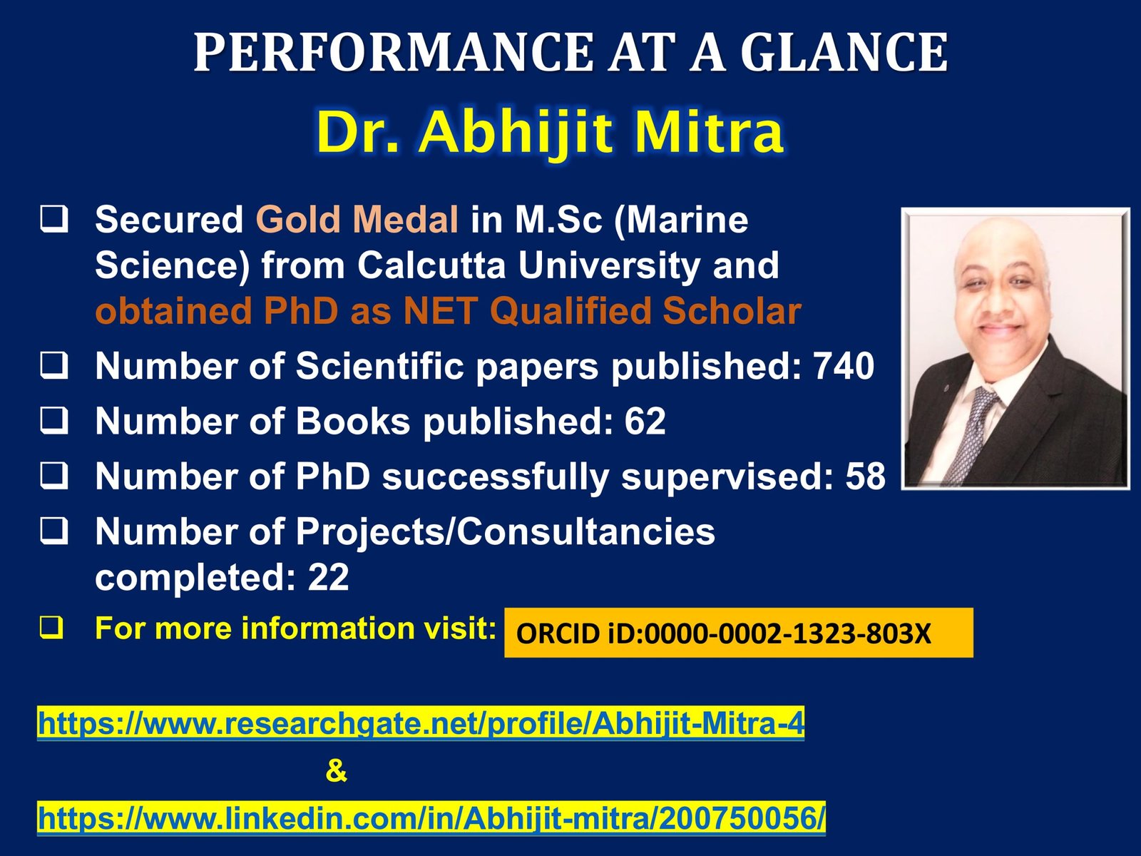 ABHIJIT MITRADirector, Research1 paper on this topic · 0 citations
 Dr. Charu JhamariaDepartment of Environmental Science ,IIS(Deemed to be University) Jaipur1 paper on this topic · 0 citations
 Prof.Dr.R.UdayakumarDean Research , SRM UNIVERSITY1 paper on this topic · 0 citations
 Dr.Suganthi NDayananda Sagar College of Engineering1 paper on this topic · 0 citations
 Ans Ibrahim MahameedTikrit University1 paper on this topic · 0 citations
 Dr.Nijaguna G SVTU1 paper on this topic · 0 citations
 Yogesh H. BhosaleCSMSS Chh. Shahu College of Engineering1 paper on this topic · 0 citations
 Rubini Bvels Institute of science technology and advanced studeis1 paper on this topic · 0 citations
 Ibeabuchi UwadiegwuUniversity of LagosLists Remote Sensing as a research area
 Pengfei JiaUniversiti Putra MalaysiaLists Remote Sensing as a research area
 Iqra TabassumGraduate Research Assistant- Sun Moon University,South KoreaLists Remote Sensing as a research area
03Papers
Research papers on Remote Sensing
- Change detection techniques for remote sensing applications: A survey2019561 citationsEarth Science InformaticsAnju Asokan
- Tech-driven forest conservation: combating deforestation with internet of things, artificial intelligence, and remote sensing202467 citationsIEEE Internet of Things JournalMasood Ur Rehman
- Remote sensing: an automated methodology for olive tree detection and counting in satellite images201858 citationsIEEE AccessFarhan Aadil
- Intelligent satin bowerbird optimizer based compression technique for remote sensing images202245 citationsComputers, Materials and ContinuaDr Prof Rajkumar Rajamanickam
- Experimental evaluation of remote sensing–based climate change prediction using enhanced deep learning strategy202444 citationsRemote Sensing in Earth Systems SciencesDr Ramakrishna Kolikipogu
- A novel MEMS-based piezoelectric multi-modal vibration energy harvester concept to power autonomous remote sensing nodes for Internet of Things (IoT) applications201522 citationsJacopo Iannacci
- Coastal aquaculture site selection and planning in Tamil Nadu using remote sensing and GIS199619 citationsDr Prof Rajkumar Rajamanickam
- A Real-Time Environmental Pollution Monitoring Framework Using Iot And Remote Sensing Technologies202513 citationsInternational Journal of Environmental SciencesDr. Yusuf Perwej
- Assessing the cropping intensity dynamics of the Gosaba CD block of Indian Sundarbans using satellite-based remote sensing202413 citationsEnvironment, Development and SustainabilitySukamal Sarkar
- Uav based remote sensing for tassel detection and growth stage estimation of maize crop using f-rcnn201912 citationsAnkit Kumar
- Thermal infrared remote sensing of hydrocarbon in Lagos-Southern Nigeria: Application of the thermographic model201710 citationsMoses EMETERE
- Prospective geothermal well and heat catchment locations in Nigeria: Remote sensing interpretations and field validation20248 citationsEnergy Exploration and ExploitationMoses EMETERE
- Modified satellite remote sensing technique for hydrocarbon deposit detection20198 citationsJournal of Petroleum Science and EngineeringMoses EMETERE
- Content-Based remote sensing image retrieval method using adaptive tetrolet transform based GLCM features20238 citationsJournal of Intelligent and Fuzzy SystemsDr R A Thakur
- Remote sensing applications: Society and environment computation of the spatio-temporal extent of rainfall and long-term meteorological drought assessment using standardized …20227 citationsRemote Sensing Applications: Society and EnvironmentDr. SATHISH KUMAR SELVAPERUMAL
- Cognitive land cover mapping: a three-layer deep learning architecture for remote sensing data classification20246 citationsEnvironmental ChallengesNalini Kanta Sahoo
- An effective model for predicting agricultural crop yield on remote sensing hyper-spectral images using adaptive logistic regression classifier20226 citationsDr Senbagavalli M
- Investigation of potential geothermal well locations in Nigeria using remote sensing and field measurement20236 citationsInternational Journal of Sustainable EnergyMoses EMETERE
- Utilizing a Novel Deep Learning Method for Scene Categorization in Remote Sensing Data20255 citationsSarwa
- Estimation of Erosion and Deposition of Krishna River Bank using Remote Sensing & GIS20195 citationsInternational Journal of Recent Technology and EngineeringKATTUPALLI SUDHAKAR
- Impact of remote sensing on irrigation management in precision agriculture20245 citationsMalak ZIRARI
- Contributions of Remote Sensing and GIS to the Inventory and Mapping of Colonial Geodetic Markers in the Katangese Copper Belt.20244 citationsRevue Internationale De GeomatiqueTSHIBANGUA WA ILUNGA John
- Identification and mapping saline-alkali wastelands in Jodhpur district, western Rajasthan using remote sensing techniques20164 citationsNeeraj Singh
- On the determination of agricultural prospects using remote sensing and field technique20163 citationsMoses EMETERE
- A Novel Pixel-based Deep Neural Network in Posterior Probability Space for the Detection of Agriculture Changes Using Remote Sensing Data20252 citationsRemote Sensing Applications: Society and EnvironmentNarayan Vyas
- Assessment of Land use/cover changes in Lower Tesua subwatershed in Chhattisgarh through Remote Sensing and GIS20172 citationsInternational Journal of Engineering and Management ResearchDr. Ajay Singh
- Design and Analysis of Wideband Single-Layer Reflectarray Antenna for Remote Sensing and Environmental Monitoring20252 citationsSensorsDr. Sachin Kumar
- Geothermal well exploration in Nigeria using remote sensing and modified thermal equations20222 citationsInternational Journal of ThermodynamicsMoses EMETERE
- Land Use Pattern mapping using Remote Sensing and GIS in Gangtok area, Sikkim Himalaya, India20092 citationsSURYA PARKASH GUPTA
- Retraction notice to “Seasonal correlation of aerosols with soil moisture, evapotranspiration, and vegetation over Pakistan using remote sensing”[Heliyon 9 (2023) e20635]20241 citationsHeliyonWulfran FENDZI MBASSO
- Enhancing remote sensing image classification using arithmetic optimization algorithm with deep learning approach20241 citationsMANIMARAN V
- A region based remote sensing image fusion using anisotropic diffusion process20221 citationsInternational Journal of Image and Data FusionSanjay Agrawal
- Mapping and Validation of Fusion‐based Classification of Land Use and Land Cover Using Remote Sensing Satellite Images20250 citationsNarayan Vyas
- RADAR: Remote Sensing Data Analysis with Artificial Intelligence20250 citationsWalter de Gruyter GmbH & Co KGNarayan Vyas
- Fundamentals of Disaster Management Using Remote Sensing20250 citationsNarayan Vyas
- Real‐Time Earthquake Monitoring with Remote Sensing and AI Technology20250 citationsNarayan Vyas
- Spatio-temporal analysis of PM2.5 and its association with elevation by using remote sensing: the scenario of Quetta, Pakistan20250 citationsAir Quality, Atmosphere and HealthDr. Malik Muhammad Akhtar
- Tree Mulberry Crop Acreage and Leaf Yield Estimation Using Remote Sensing and Geographical Information System20240 citationsInternational Journal of Research and Analytical Reviews (IJRAR)MANJUNATHA H B
- Interactive AI System for Remote Sensing Change Detection and Analysis20250 citationsDr. Mohammad Pasha
- EQCNN: Enhanced Remote Sensing Imagery Classification with Circuit-Based Error-Corrected Quantum Convolutional Neural Networks20250 citationsDr Mueen Uddin
- ADVANCED LIGHTWEIGHT ST-TCN FRAMEWORK USING UAV MULTI-SPECTRAL REMOTE SENSING FOR SURVEILLANCE AND CONTROL OF PINE NEMATODE20240 citationsJournal of Theoretical and Applied Information TechnologyDr. V. Gokula Krishnan
- Estimation of Potential GHG Emissions From Biomass Burning in Northeastern Region of India Using Remote Sensing and GIS20020 citationsABHIJIT MITRA
- Landuse Pattern Mapping using Remote Sensing and GIS in Gangtok Area, Sikkim Himalaya20090 citationsSURYA PARKASH GUPTA
- Remote Sensing and Machine Learning20230 citationsDr. Charu Jhamaria
- Remote Sensing and Spatial Statistics as Tools in Crime Analysis20230 citationsProf.Dr.R.Udayakumar
- Future Trends in IoT, Control Systems, and Remote Sensing Integration for Precision Agriculture20250 citationsDr.Suganthi N
- The Efficiency of Digital Image Processing Applications to Reduce the Disasters by Using Remote Sensing Data: A Review20210 citationsAns Ibrahim Mahameed
- Content-Based Image Retrieval for Remote Sensing Images using Hybrid Firefly and Grey Wolf Optimization Algorithm20230 citationsDr.Nijaguna G S
- Meteorology-Net: A Deep Learning Framework for Multi-class Weather Phenomenon Detection, Classification and Forecasting Using Remote Sensing Data20260 citationsNational Academy Science LettersYogesh H. Bhosale
- A comprehensive review: hyperspectral image enhancement and various classification techniques in remote sensing applications20240 citationsRubini B
04Journals
Journals that publish Remote Sensing research
Where our researchers published their papers on this topic, with each journal’s indexing.
| Journal | Indexing | Impact factor* | Papers |
|---|---|---|---|
| Remote Sensing Applications: Society and Environment | ESCIScopusJCR 2024 | 2.96 Q3 | 2 |
| Heliyon | SCIEScopusJCR 2024 | 9.51 Q1 | 1 |
| IEEE Internet of Things Journal | SCIEScopusJCR 2024 | 6.45 Q1 | 1 |
| Walter de Gruyter GmbH & Co KG | Not listed in our indexing lists | – | 1 |
| IEEE Access | SCIEScopusJCR 2024 | 6.50 Q1 | 1 |
| International Journal of Environmental Sciences | Scopus | 0.13 | 1 |
| Air Quality, Atmosphere and Health | SCIEScopusJCR 2024 | 3.18 Q3 | 1 |
| Environmental Challenges | Scopus | 5.23 | 1 |
| Computers, Materials and Continua | Scopus | – | 1 |
| International Journal of Research and Analytical Reviews (IJRAR) | Not listed in our indexing lists | – | 1 |
| International Journal of Engineering and Management Research | Not listed in our indexing lists | – | 1 |
| Sensors | SCIEScopusJCR 2024 | 5.82 Q1 | 1 |
| Journal of Theoretical and Applied Information Technology | Scopus | 0.00 | 1 |
| International Journal of Recent Technology and Engineering | Scopus | 0.56 | 1 |
| Energy Exploration and Exploitation | SCIEScopusJCR 2024 | 4.62 Q2 | 1 |
*Impact factor and quartile calculated from OpenAlex open data where available; official Journal Impact Factors are published by Clarivate. Indexing from the SCIE, SSCI, AHCI, ESCI, Scopus and JCR 2024 lists. Find the right journal for your own paper →
05Top 2% scientists
World’s Top 2% scientists in Geography
The Stanford/Elsevier World’s Top 2% Scientists list ranks researchers by a composite citation indicator. Geography is the research subfield closest to Remote Sensing in that list; 448 researchers from 30 countries are listed in it.
| Researcher | Institution | Country | World rank |
|---|---|---|---|
| Peck, Jamie A. | The University of British Columbia | Canada | 1,367 |
| Anselin, Luc E. | The University of Chicago | United States | 1,580 |
| Thrift, Nigel J. | University of Bristol | United Kingdom | 2,076 |
| Boschma, Ron A. | Universiteit Utrecht | Netherlands | 2,573 |
| Kwan, Mei Po | Chinese University of Hong Kong | Hong Kong | 2,584 |
| Poesen, Jean W.A. | Uniwersytet Marii Curie-Sklodowskiej w Lublinie | Poland | 2,796 |
| Harvey, David | The Graduate Center | United States | 3,017 |
| Liu, Yansui | Institute of Geographic Sciences and Natural Resources Research, Chinese Academy of Sciences | China | 3,112 |
| Swyngedouw, Erik A. | The University of Manchester | United Kingdom | 3,514 |
| Kitchin, Rob | Maynooth University | Ireland | 3,884 |
| Wohl, Ellen E. | Warner College of Natural Resources | United States | 3,924 |
| Martin, Ron L. | University of Cambridge | United Kingdom | 4,088 |
Source: Elsevier Data Repository, Ioannidis et al., 2026 edition, citations to the end of 2025 (career-long ranking). ScholarsColab is not affiliated with Stanford University or Elsevier, and the researchers listed are not ScholarsColab mentors unless marked so above.
06Related topics
Topics related to Remote Sensing
Topics that share the most papers with Remote Sensing in our researchers’ work:
- Remote Sensing Applications3 papers · 3 researchers
- Geographic Information System (GIS)38 papers · 21 researchers
- Himalaya33 papers · 8 researchers
- Precision Agriculture42 papers · 34 researchers
- Unmanned Aerial Vehicles (UAV)89 papers · 50 researchers
- Agriculture252 papers · 133 researchers
- Deep Learning (DL)968 papers · 331 researchers
- Artificial Intelligence (AI)1,196 papers · 404 researchers
- Internet of Things (IoT)1,334 papers · 356 researchers
- Neural Network819 papers · 267 researchers
07Questions
Frequently asked questions
What do researchers study in Remote Sensing?
In papers by ScholarsColab researchers, Remote Sensing appears most often together with image, detection, technique, application, deep, learning. Work since 2024 focuses most on deep, classification, learning, data.
Who works on Remote Sensing research?
42 PhD researchers on ScholarsColab have published on Remote Sensing (50 papers), including Moses EMETERE, Narayan Vyas, Dr Prof Rajkumar Rajamanickam. Each has a public profile with their Google Scholar publications, and you can hire them as a mentor or for a research project.
Which journals publish Remote Sensing research?
Our researchers published their Remote Sensing papers in 25 journals, most often in Remote Sensing Applications: Society and Environment, Heliyon, IEEE Internet of Things Journal, Walter de Gruyter GmbH & Co KG. The journal table on this page shows the indexing of each one (SCIE, Scopus, ESCI).
How many research papers on Remote Sensing are on ScholarsColab?
50 papers published between 1996 and 2026, cited 952 times in total (median 2 citations per paper). The list updates automatically as researchers join and publish.
Can I hire a PhD expert in Remote Sensing for my thesis or paper?
Yes. Open any researcher profile on this page to see their publications, then post your project or hire them directly. For a paper you have already written, a Manuscript Audit by a reviewer in Remote Sensing shows what to fix before you submit, and Journal Selection shortlists up to five journals that match it.
Need a PhD expert in Remote Sensing?
Hire a researcher who has published on this topic to guide your thesis or project, or get your manuscript audited and matched to the right journal before you submit.